Lakeshore Stewardship Highlighted Following Spring Flooding

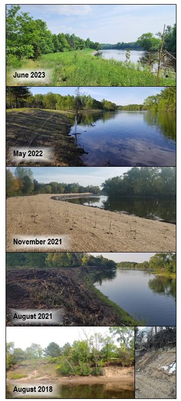
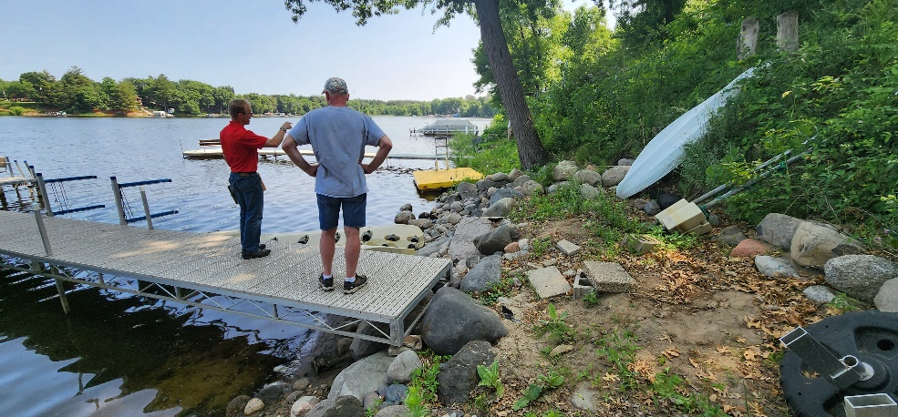
High water levels combined with strong winds impacted lakeshores throughout Minnesota this spring. In some cases, already-eroding and unprotected shorelines receded by multiple feet. In others, existing structures such as timber retaining walls were damaged – drastically compromising the land above. These occurrences highlight the importance of lakeshore practices that create resilient, stable, and healthy shorelines. ACD is working to maximize technical and financial resources to assist landowners with their shoreline restoration needs.

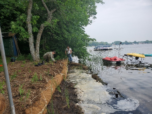
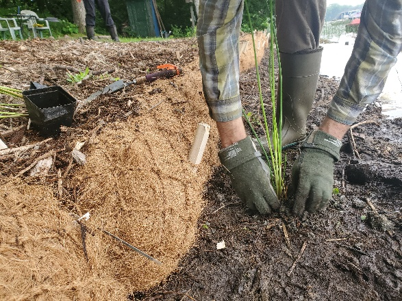
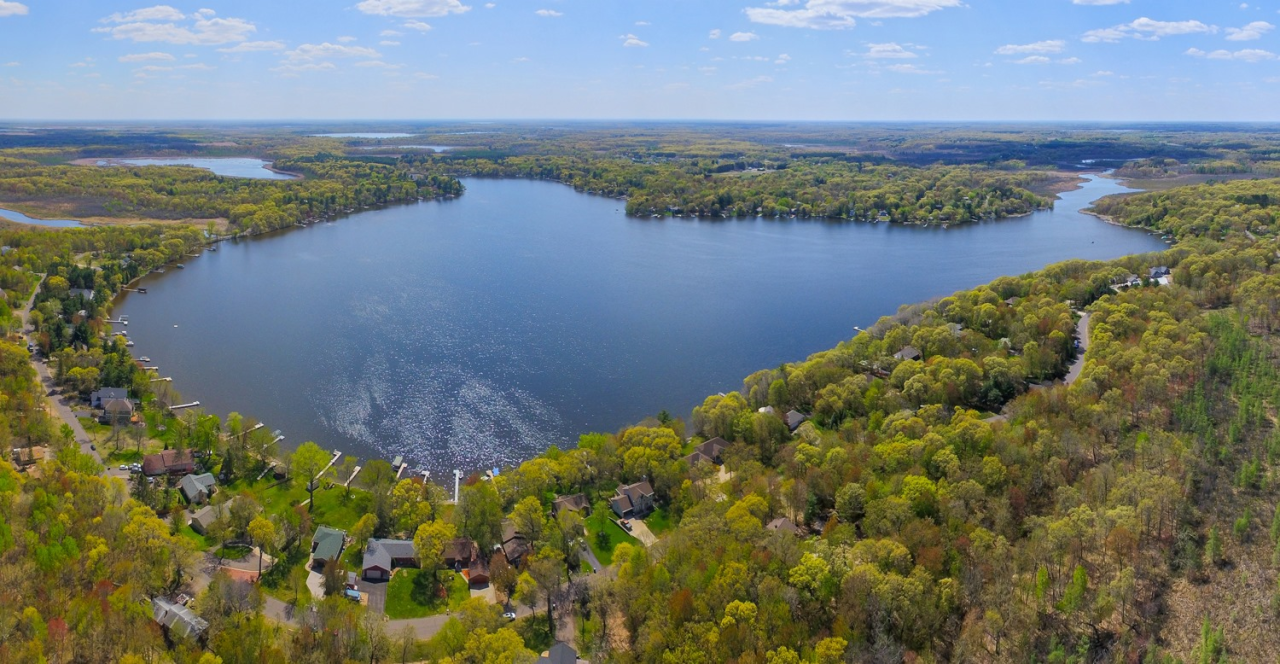
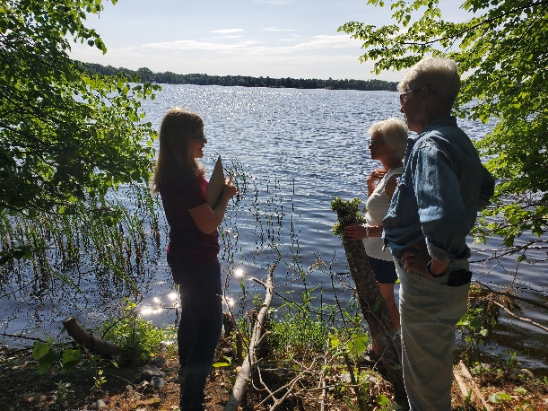
Martin Lake, located in northern Anoka County, was particularly impacted by spring flooding. Fortunately, grant funds were recently secured to provide assistance with restoration and stabilization efforts on this lake. Many landowners are interested in addressing erosion and improving wildlife habitat on their shorelines; in total, ACD staff met with residents at 20 different properties. Properties providing the greatest opportunities for water quality and ecological benefits will be selected for partial funding through available grants, and recommendations/ guidance will be provided for the remainder.

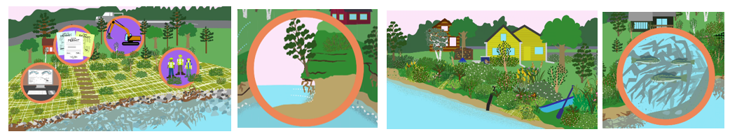
If you notice erosion on your shoreline or otherwise want to enhance its resiliency and ecological value, check out our "Our Lakeshore Connection" animated video to learn more:


Or contact Breanna Keith at This email address is being protected from spambots. You need JavaScript enabled to view it., 763.434.2030 x160

  863 Hits

PROJECT UPDATE - RIVERBANK STABILIZATION IN MISSISSIPPI RIVER COMMUNITY PARK, ANOKA

Approximately 1,500 feet of severely eroding riverbank in Mississippi River Community Park was stabilized in late 2021. The project included tree clearing, bank reshaping, riprap, erosion control blanket, seeding, and planting of a variety of native plant species.

Since installation, the site has been subjected to high water in 2022 and 2023. Both the riprap on the lower elevations of the bank and the vegetation on the upper elevations have successfully stabilized the site.

Moving forward, you may observe some vegetation maintenance to help the native species establish. Some examples include supplemental planting of native species and mowing to a height of approximately 6" to limit weed species from dispersing seed.

The project was funded by a Clean Water Fund grant, a Watershed Based Funding grant, and match from the City of Anoka. 

For more information about the project contact Mitch Haustein at This email address is being protected from spambots. You need JavaScript enabled to view it. or 763.434.2030 x150

  745 Hits

Spring Fix-Ups to Protect Valuable Real Estate

Shorelines are some of the most valuable real estate. Both financially and ecologically. The Anoka Conservation District (ACD) has stabilized nearly 4.5 miles of eroding stream or riverbank and 1 mile of lakeshore over the years. When possible we use natural materials, a technique called bioengineering, to create stable, beautiful places that benefit lake or river health.

Near-record snowfalls in winter 2022-23 gave way to spring flooding that impacted many shorelines. Making matters worse, just after ice out there were several days of strong north winds. South shores of our bigger lakes took a beating. The shorelines most impacted were those that are mowed to the edge and without other protections such as riprap. Some of ACD's fall 2022 shoreline bioengineering projects were impacted because the vegetation had not had time to mature.

In recent weeks ACD staff have repaired damaged projects, including at Lake George (see photos).One of the beauties of bioengineering is that a few people with basic tools can make quick work of repair. After growing and establishing this summer, these lakeshores will be ready for whatever next spring brings.

Shoreline homeowners interested in creating stable, ecologically-friendly shorelines can contact Jamie Schurbon, Watershed Projects Manager at 763.434.2030 x210 or This email address is being protected from spambots. You need JavaScript enabled to view it..

  610 Hits

The Power of Grassroots Fundraising & Partnerships

Congrats to the Martin Lakers Association on their efforts to improve water quality. At their recent annual meeting 81% of member households contributed $7,000 to the group's Water Quality Fund.23 households gave $100 or more. Of this amount, $3,000 was a match provided by the Wally & Nancy Olson family in memory of Nancy. The Martin Lakers Association has used the funds to partner with the Anoka Conservation District on numerous projects including stormwater pond enhancements, rain gardens, carp management, and more that have approached $1M.Lake associations, citizen groups, and landowners are critical partners of ACD in most of what we do.  

For more information contact Jamie Schurbon at This email address is being protected from spambots. You need JavaScript enabled to view it. or 763.434.2030 x210 

  626 Hits

Private Well Water Testing

Unlike city water, water from private wells is not tested unless the homeowner tests it, which all are encouraged to do. To make it easy, Anoka County Public Health and Environmental Services Department offers testing. The homeowner collects the sample and delivers it to the government center in Anoka. Test kits can be picked up at most city halls. Costs are about $17 for each contaminant, with nitrates and coliform bacteria as the usual minimums to test. 

For more information see www.anokacounty.us/water.  

  588 Hits

Check out a recap of ACD's 2023 Tree Sale!

Enter your text here ...

  674 Hits

“Our Riverbank Connection” Animated Video

Recent extreme flooding has highlighted the dynamic and powerful nature of flowing water. If you live on a river or even a smaller stream, you've likely witnessed these characteristics and their impacts firsthand. With flood waters receding, now is a great time to assess the condition of your riverbank and consider stewardship and stabilization approaches that will help protect your property and the water you live on. Fortunately, we've created a brand new resource to help guide you through this process – the "Our Riverbank Connection" animated video!

Living by a creek, stream, or river provides many benefits and a unique opportunity to support water quality and wildlife. It also comes with some challenges such as erosion, which can eat away at your land over time. In this video, you will learn how to create a river-friendly lawn and riverbank that also protects your property by reducing or repairing losses from erosion. Video topics include:

  • Recommended lawn care practices
  • Signs of erosion and factors that may make your bank more susceptible to it
  • Creating a well-vegetated bank
  • Bank stabilization approaches to address active erosion
  • Project planning and construction – what to expect

Watch "Our Riverbank Connection" here: https://www.youtube.com/watch?v=Et9wLuIrRuA

Want to learn more about streams and rivers and how you can help them, even if you don't live on their banks? Watch Part 1 of the "Our River" Installment – "Our River Connection" – here: https://www.youtube.com/watch?v=rdQEcmLyQJI 

  689 Hits

The Lasting Impact of Conservation Corps Minnesota & Iowa

The Anoka Conservation District (ACD) has been a long-time partner of Conservation Corps Minnesota & Iowa (CCMI) and this tradition continues in 2023. This year, ACD was awarded 32 CCMI crew days to be used towards implementing streambank stabilization practices along the Rum River in Anoka County. Crews are deployed, a week or more at a time, to a specific project site. ACD will act as the project host to coordinate projects, provide equipment and materials, and utilize ACD's expertise for extensive on-site training and education.

The majority of Corpsmembers are recent college graduates and these field crew positions provide members the opportunity to learn how soil and water conservation districts and other professional organizations operate. ACD strives to provide in-depth training on project installation, project goals, site identification, and touch on other critical aspects of a project. Additionally, extensive time in the field allows ACD staff get to know the Corpsmembers and contribute insight into their professional development and growth within their career path.

CCMI field crews serve the greater outdoors by restoring habitat, managing natural resources, and occasionally responding to natural disasters or emergency needs of a community. The Field Crew program prioritizes personal and professional growth while teaching hands-on conservation skills in the field. Corpsmembers develop technical skills throughout their term while completing challenging and impactful conservation projects. Many projects are performed in partnership with public land management agencies such as the Department of Natural Resources, US Fish & Wildlife Service, National Park Service, cities, counties, and trail associations.

Working in a field crew blends hard work, community service, and environmental stewardship while also gaining additional life-long skills. Corpsmembers often have a transformational experience during their term, leaving them feeling more prepared for whatever comes next. 

Visit the Conservation Corps website to learn more about the organization and available career opportunities. 

https://conservationcorps.org/programs/field-crews/ 

  578 Hits

Rescuing Rubus fulleri – State Threatened Species

The Anoka Sand Plain Rescue team salvaged rubus fulleri just days after the snow melted and the take permit was issued. A recent development was designed to avoid impacts to natural/uncropped wetlands and leave a natural area that contains most of the rare plants on the site. However, a subpopulation of rubus fulleri was to be impacted since there was no feasible way to avoid the areas due to construction constraints. 


Staff from ACD, Critical Connections Ecological Services and the MN Landscape Arboretum salvaged whole plants and cut stems/canes. Plants were taken to the MN Landscape Arboretum where they will be potted. Stems/canes were cut into pieces ensuring each piece included a bud and was potted. The Arboretum is experimenting with different propagation techniques and will keep the rubus  on-site until the fall. At that time, plants will be transferred to ecologically appropriate protected site where they can be monitored for survival and growth.  

Root tipping – yellow circles show rooting at the base and the tip

Rubus fulleri was designated as a state-threatened species in 2013. In Minnesota, this species is restricted to the shallow wet meadows of the Anoka Sand Plain. Following a century of agricultural and residential development in this region, few high quality examples of R. fulleri habitat are known in the state. Rubus fulleri is most threatened by habitat loss, with populations becoming more isolated and fragmented. Active management, including prescribed fire and invasive species control is needed to maintain a viable R. fulleri population.

Rubus Anatomy:

Cane: a biennial, woody shoot which grows out of the perennial crowns and roots

Primocane: first year cane, mainly comprised of vegetation growth

Floricane: the same cane in the second year, bearing the flowers and fruits, then dies back


Rubus fulleri traits include canes that arch and trail along the ground. They also root tip, meaning the tip of the trailing cane grows roots into the ground. 

For more information contact Carrie Taylor at 763.434.2030 ext.190 or This email address is being protected from spambots. You need JavaScript enabled to view it..

  595 Hits

Lawns to Legumes Grant Application Open Now!

The MN Board of Water and Soil Resources (BWSR) is accepting applications for the Lawns to Legumes grant program through June 30, 2023. Any Minnesota landowner can apply for up to $350 in reimbursements for creating new pollinator habitat on their property. This includes pollinator gardens or meadows, bee lawns, and native tree or shrub plantings.

Grant recipients must contribute 25% match in the form of purchasing materials, hiring contractors, or as in-kind time spent planting and maintaining the project.

Find resources for planning your pollinator planting, choosing native plants, and applying for a grant on the BWSR Lawns to Legumes website. 

  856 Hits

Dellwood River Park Shoreline Stabilization – Project Update

A design has been finalized to stabilize 650-feet of eroding Rum Riverbank at Dellwood River Park in St. Francis. Erosion of the riverbank is causing numerous trees to fall into the river and is threatening a popular walking trail. The project design, currently in the permitting phase, features three primary protection measures;

  • 1) Two severely eroding zones of riverbank encroaching on the trail will be built back out, armored with rock riprap, and potentially have large tree root-wads added to provide in-stream habitat elements. The riprapped length of bank will total approximately 180-feet in length.
  • 2) Three bendway weirs constructed of rock will protrude at a 45° into the river. These low-lying, linear features will be submerged under the water, and will push flow and erosive scour back toward the middle of the channel, rather than along the outer bank. The bendway weirs will also add variable flow areas and habitat value in the channel. These will be great features to cast around for any fisher folks from shore!
  • 3) And finally, the less severe eroding areas of riverbank will be armored with cedar trees in a technique called a "cedar tree revetment". Cut eastern red cedars will be cabled together in a shingled fashion along the bank and secured with earth anchors driven into the soil. This is a bioengineering approach that is softer and less expensive than rock which should help the bank stabilize, vegetate, and stabilize over time before the cedar trees eventually rot away.

For more information contact Jared Wagner at 763.434.2030 ext.200 or This email address is being protected from spambots. You need JavaScript enabled to view it..

  662 Hits

SONAR AS A DESIGN TOOL FOR SHORELINE STABILIZATION PROJECTS

Data collection on the Rum River.

ACD staff have been testing the use of sonar to aid with the design of shoreline stabilization projects.

Lake and river bottom elevations are often required when designing projects. Collecting these bottom elevations manually with survey equipment often pose safety risks, limits resolution, and can be time consuming. Automated collection of underwater elevation data is possible with readily available sonar technology and post-processing services. Manually collecting data at the same resolution is infeasible.

A fishing depth finder and transducer combination with active mapping capabilities is necessary for data collection. The equipment can be configured in a portable setup for use in a kayak, canoe, or motorized boat to enable data collection on a variety of waterbodies (e.g. stormwater ponds, lakes, or the Mississippi River). While idling or paddling around the area of interest, data is collected and stored on a memory card and then uploaded to a third-party software for post-processing.

Technology limitations still remain, but the end products provide a picture of the underwater landscape through a variety of file types that are useful for project design, mapping, and inventory work. 

For more information contact Mitch Haustein at 763.434.2030 ext. 150 or This email address is being protected from spambots. You need JavaScript enabled to view it..

  571 Hits
Tags:

Minnesota Gets New LiDAR Data

LiDAR stands for Light Detection and Ranging. The landscape is mapped by laser pulses projected from a low-flying airplane. These pulses bounce back to a sensor which records the location of the airplane, the angle of the pulse, and the time it takes the light to bounce back. Using that information, the system is able to create a point cloud of the landscape. This point cloud is then converted into modeled surface of the ground called a Digital Elevation Model (DEM). This model can be used to map terrain features like water flow paths and drainage areas, geologic features, infrastructure, and many others.

The first generation of LiDAR data in Minnesota was collected from 2008-2012. Since then, the landscape has changed in untold ways, and technology has dramatically improved for collecting more dense and accurate data. Because of this, the 3D Geomatics Committee of the State's Geospatial Advisory Council set out to coordinate the collection of Generation 2 LiDAR in Minnesota. This effort is currently underway in partnership with the USGS as the lead data collection entity nationally, and counties and other local partners as the ultimate data recipients. Generation 2 LiDAR data collection started in 2021. Anoka County data was collected in 2022, and will be available in 2023.

This new data will allow us to map watercourses, drainage areas, and floodways in much higher resolution and with more accurate and recent data from the landscape. We'll also be able to assess eroding slopes like those along riverbanks for height, steepness, and stability without having to traverse them with survey gear. Because the new data is so robust, it is also opening up possibilities for forestry and vegetation surveys, very detailed mapping of infrastructure, and untold uses yet to be implemented or even thought of.

For more information about this incredibly useful public data, visit the Minnesota LiDAR Hub online at: https://lidarhub-minnesota.hub.arcgis.com/ 

LiDAR produced Digital Elevation Model (DEM) left, aerial photography right, along a river in Minnesota.
  1390 Hits
Tags:

ACD's New Grading System

2022 Report Card
ACD recently took the time to look back on 2022 and take stock in how well we've been doing to implement our 2021-2030 Natural Resources Stewardship Plan. We looked at 24 Keystone Endeavors across four priority natural resources, our human resource (community), and internal operations. We also considered foundational knowledge gained through monitoring, inventory, analysis and planning. 

10-year Goals
A prerequisite to gauge success was to define clearly our 10-year expectations and aspirations for each keystone endeavor based on our current and anticipated staff and financial capacity. Some goals are easily quantified measured while others are more subjective. 

  689 Hits

Garlic Mustard Pull at Cedar Creek Ecosystem Science Reserve

Garlic Mustard

Garlic Mustard Pull at Cedar Creek Ecosystem Science Reserve
May 16th, from 9:00 am - 11:00 am


Join ACD and Cedar Creek staff to remove an invasive Garlic Mustard patch from the interior of Cedar Creek property. Bring bug spray, water bottle, long pants and hiking boots as we walk to the site. Utilize this on-hands training to learn more about how to identify and remove garlic mustard.

Work tools and other supplies will be provided.

For more information visit the event page or contact
Carrie Taylor at 763-434-2030 ext. 190 or This email address is being protected from spambots. You need JavaScript enabled to view it.
  576 Hits