Effective land management and development decisions depend on accurate, up-to-date information. Whether reviewing a development proposal, planning a conservation project, or addressing environmental concerns such as erosion, decision-makers need reliable data to understand existing conditions and identify potential impacts.
For example, community leaders reviewing a development project may be able to protect important natural resources by modifying site plans, but only if those resources have been identified and mapped. Likewise, natural resource professionals can more effectively target restoration and conservation efforts when they know where environmental problems are occurring.
To support informed decision-making, ACD conducts and maintains a variety of natural resource inventories throughout Anoka County. These inventories provide valuable information for local governments, landowners, developers, conservation organizations, and the public. Through this website and our mapping tools, that information is readily available to help guide responsible stewardship of our natural resources.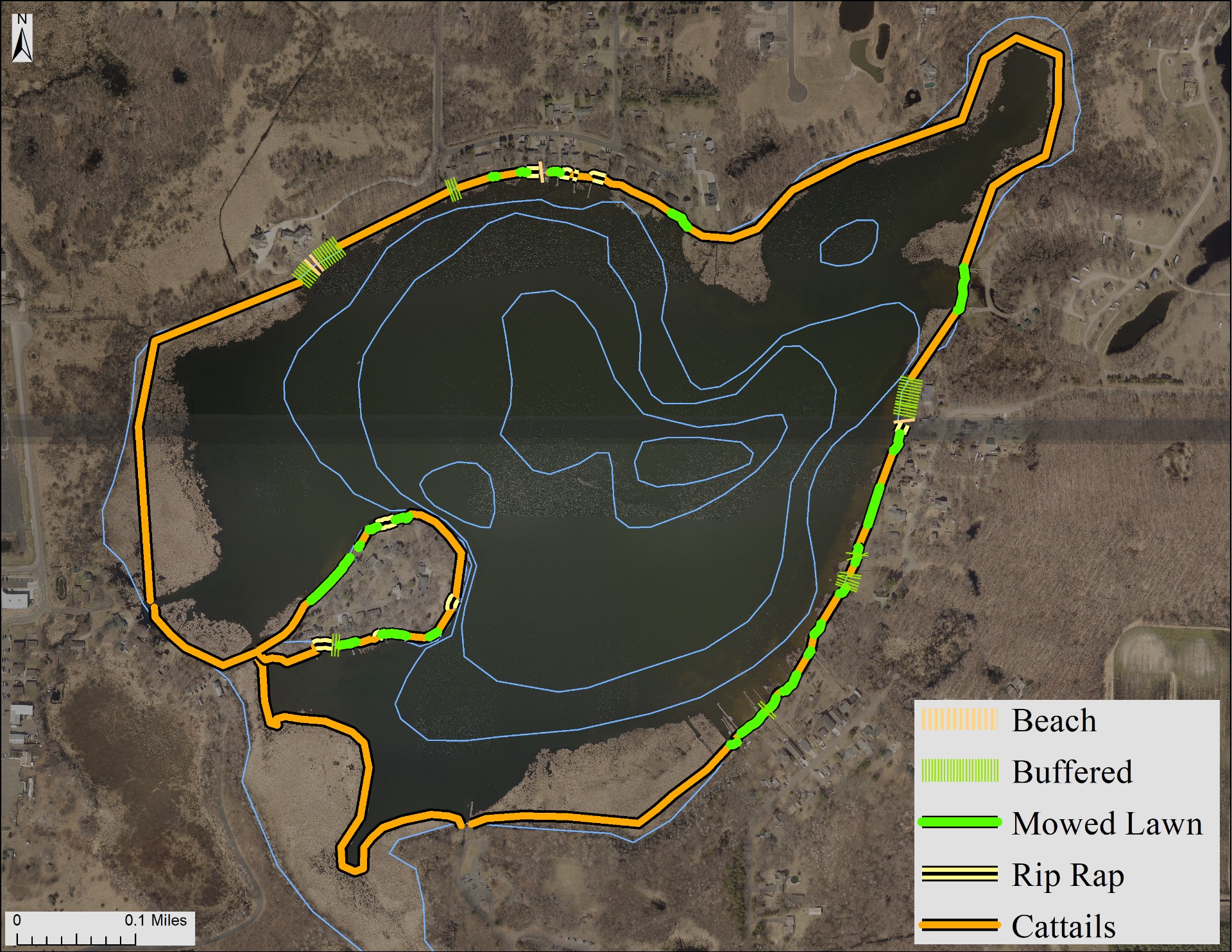
Inventories conducted to date, or in progress, include:
Land Cover Inventory
ACD maintains a countywide land cover inventory using the Minnesota Land Cover Classification System (MLCCS) within a Geographic Information System (GIS). This inventory maps existing land cover types in high detail, allowing users to identify features such as dominant tree species within woodlands, wetland types, grasslands, and varying levels of urban development. These data support natural resource planning, habitat assessments, and conservation project prioritization.
The land cover inventory can be viewed using ACD's Mapping Utility.
Digital Soil Survey
In partnership with the United States Department of Agriculture Natural Resources Conservation Service (USDA-NRCS), ACD converted the county's historic soil survey into a digital format. Digital soil data can be integrated with GIS applications, engineering plans, aerial photography, and other mapping tools, making it more accessible and useful for land management, development review, and conservation planning.
The digital soil survey can be viewed using ACD's Mapping Utility.
Shoreland Inventory
ACD conducts shoreline inventories to document shoreline conditions and management practices on lakes and streams throughout the county. These inventories identify characteristics such as shoreline erosion, vegetation buffers, and maintained turf areas.
ACD Contact :
Land Related:
Water Related:
Links Below: