Seasonally Dry: Low Water Levels in Anoka County 

As of August 4, 2026, the U.S. Drought Monitor classified all of Anoka County as being in moderate drought. However, the causes and effects of low water levels are often complex. Water levels reflect the combined effects of precipitation, snowmelt, temperature, groundwater conditions, and water use—and different water bodies can respond at different rates.

Where Did the Water Go?

During dry periods, less rain and snowmelt are available to replenish lakes, streams, wetlands, and groundwater. Heat waves (like we have experienced this summer) can intensify these conditions by increasing evaporation from open water and moisture loss from plants and soil. Hot weather also increases demand for lawn irrigation, placing additional pressure on groundwater supplies. When extreme heat, limited rainfall, and increased water use occur together, water levels can decline more quickly.

Groundwater is especially important in Anoka County, as ~94% of residents receive their drinking water from groundwater. Many local lakes and wetlands are closely connected to the water table, while groundwater also helps maintain streamflow between rain events. When groundwater declines, nearby surface waters may remain low even after rainfall. A single storm can temporarily improve conditions, but sustained precipitation is often needed for recovery. 

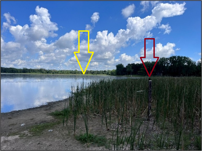
Photo: Coopers Lake in northern Anoka County. The red arrow marks the 2025 monitoring location, which was completely dry by summer 2026. The yellow arrow marks the relocated 2026 monitoring location.

Why Low Water Levels Matter

Shallow water warms more quickly, which can stress out fish and other aquatic life. Reduced streamflow may limit habitat and decrease the amount of cool, oxygen-rich water available to aquatic organisms. Pollutants and nutrients can also become more concentrated when less water is available to dilute them. Shorelines, rocks, stumps, and other hazards may become exposed, affecting boating and water access.

Wetlands naturally expand and contract, and some periodically dry out. These dry phases can benefit certain plants and wildlife. Long-lasting drought, however, can reduce habitat and lower shallow groundwater levels across the surrounding landscape. 

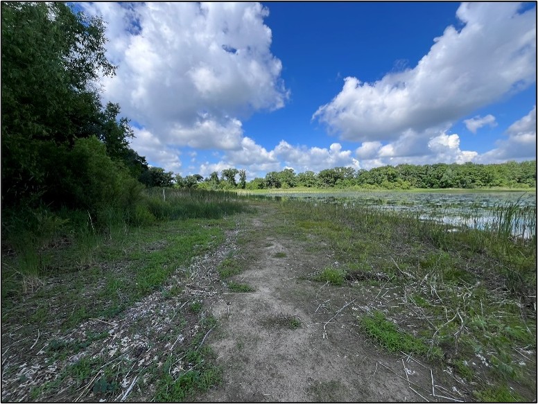
Photo: Exposed lakebed on Coopers Lake. Although prolonged drought creates serious concerns, occasional low-water periods can benefit shallow-lake ecosystems by exposing dormant seeds, encouraging native wetland vegetation, consolidating sediment, and creating valuable wildlife habitat.

 What Residents Can Do

Everyone can help reduce pressure on local water resources during these dry/hot conditions:

• Follow watering restrictions or schedules established by your city.
• Water lawns and gardens during the early morning, when less water is lost to evaporation.
• Water deeply but less frequently and allow established lawns to go dormant when practical.
• Repair leaking faucets, toilets, hoses, and irrigation systems.
• Use native plants adapted to Minnesota's climate that generally need less water once established.
• Maintain natural vegetation along shorelines to protect soil, provide habitat, and reduce polluted runoff.
• Avoid fertilizing immediately before rain and keep yard debris and other waste out of streets and water bodies.
• Do not dredge, fill, remove aquatic plants, or reshape shoreline or lakebed without first checking permit requirements.

Water Levels Can Recover—but It Takes Time
Water resources do not always respond immediately when rain returns. Soil moisture may need to recover before water can infiltrate deeply enough to recharge groundwater. Lakes, wetlands, and streams that depend on groundwater may therefore recover more slowly than rainfall totals alone suggest.

ACD and its partners track precipitation, lake and stream conditions, wetland hydrology, and groundwater levels throughout the county. Residents can find statewide drought updates through the MN DNR or contact Kris Larson, Water Resource Specialist, at This email address is being protected from spambots. You need JavaScript enabled to view it..

  96 Hits

ACD's Meaningful Partnership with Conservation Corps MN

For organizations like ACD, working with a Conservation Corps of Minnesota & Iowa (CCMI) field crew can be much more cost-effective than using contractors for local conservation work and can also help train the next generation of natural resource professionals. The crews are supervised, equipped, and can be assigned to projects lasting from a single day to several months. 

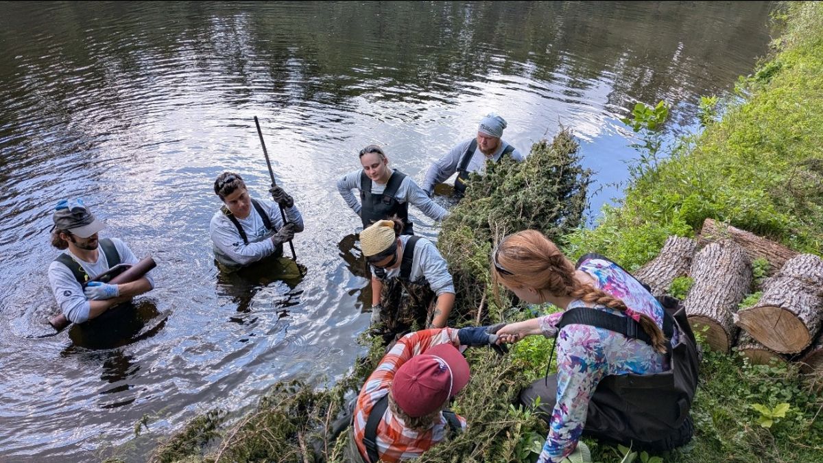
Photo: ACD staff teaching a metro CCMI crew how to install a cedar tree revetment on a private shoreline of the Rum River. This metro crew will work with ACD throughout the summer, allowing them to continue their professional development.

Many young adults join CCMI for a mix of experience, training, student loan benefits, their love of the outdoors and the desire to make a difference. For many professionals in Minnesota, a season with CCMI is a stepping stone to landing permanent jobs in conservation, forestry, parks, or environmental science.

By working alongside the crew members, ACD staff can share their knowledge and experience to provide real mentorship. Check out the CCMI website to learn more about their mission and employment opportunities. For more information contact, Kris Larson, Water Resource Specialist, at This email address is being protected from spambots. You need JavaScript enabled to view it..
  239 Hits

MNDNR Evaluates Cedar Revetments in Anoka County 

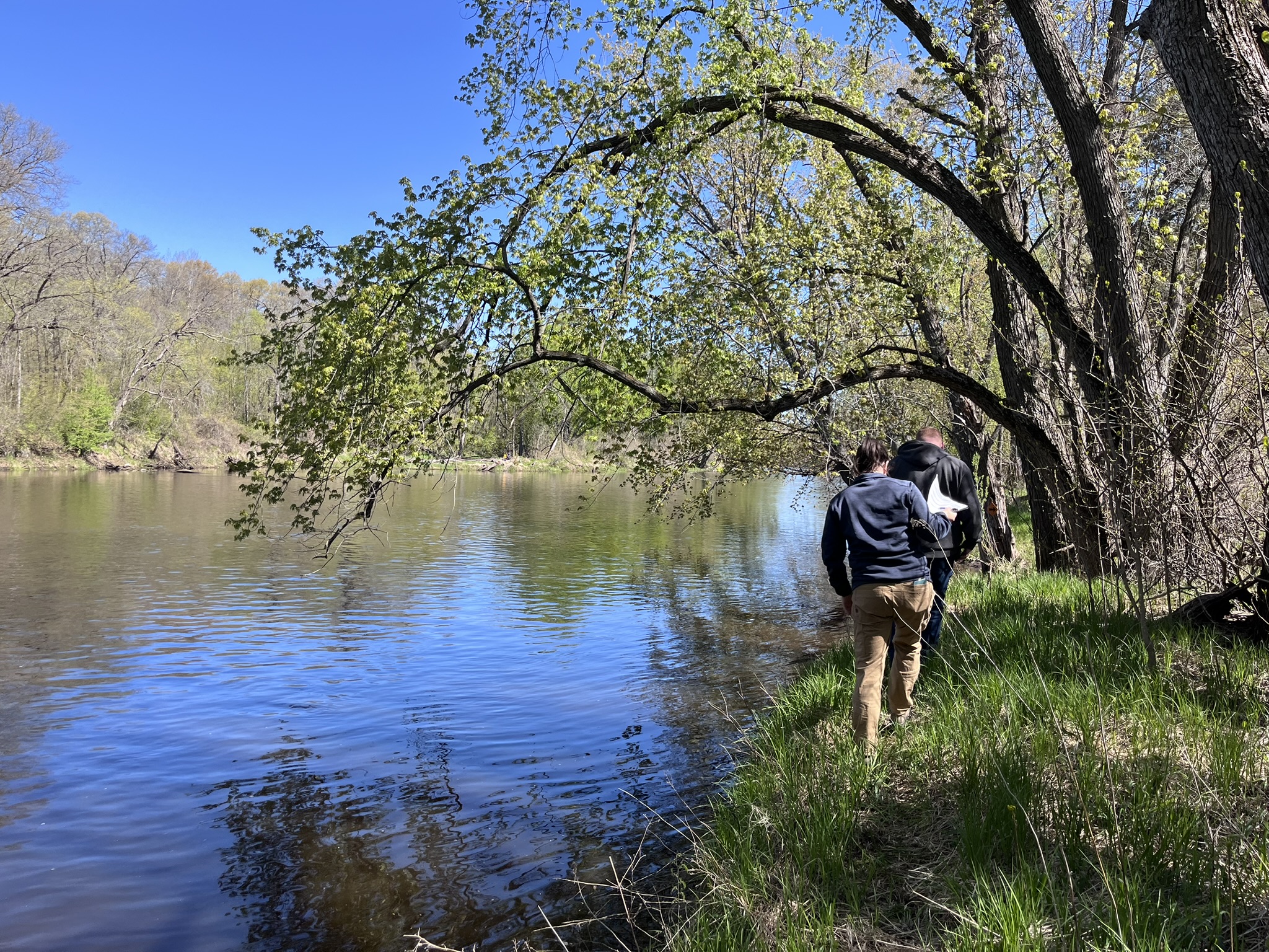
Photo: Anoka County Parks Manager, Quinn Palar, and CPL Program Administrator, Amy Yoelin, walking on top of a Rum Riverbank in Anoka County.

The Rum River has over 7 miles of shoreline with some degree of erosion. Riverbank stabilization practices protect property, enhance shoreline habitat, and improve downstream fisheries by improving water clarity and protecting spawning areas. Cedar tree revetments are among the most cost-effective means of addressing moderate riverbank erosion before it worsens.

Anoka County Parks was awarded a Conservation Partners Legacy grant to install 2,500 feet of cedar revetment on eroding sections of the Rum River. ACD was contracted by Anoka County Parks and completed this work between 2023 and 2025. ACD overdelivered by installing 2,933 feet of revetment within available funds.

Cedar tree revetments use Eastern red cedar trees anchored along an eroding riverbank to slow the current. This decreases erosion and allows silt and sand to deposit. The deposited material forms a seedbed. By the time the cedar trees have decayed, the bank is stabilized by the roots of the living trees. 

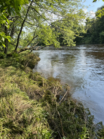
Photo: A cedar revetment installed on the Rum Riverbank to slow the current and reduce erosion.

The MNDNR was excited about what they saw and encouraged Anoka County Parks to continue their revetment program, which is now in its 3rd phase. With the support from the state, Anoka County Parks will likely apply for another phase of funding this coming August.

Restoring streambanks and establishing habitat along public riverbanks will benefit the thousands of Anoka County residents who frequent local parks, as well as Rum River enthusiasts each year. For more information, contact Kris Larson, Water Resource Specialist, at This email address is being protected from spambots. You need JavaScript enabled to view it.

  453 Hits

Quick Guides for Spring Planting

It's spring and many of us are thinking about planting!. Many great online resources exist to help guide landowners. The links below will bring you to webpages on pollinators, site identification, plant selection, planting hints, and much more:

Resources for shoreline areas

The list above was compiled by the MNDNR in their March 2026 Water Talk Newsletter.

  545 Hits

New Boats Leaving a Path of Destruction in Their Wake

The University of Minnesota, St. Anthony Falls Laboratory (SAFL), conducted a study that researched three distinct hydrodynamic phenomena that are produced by common recreational powerboats and that have the potential to impact the water column and lakebed: 1) bow and stern pressure waves, 2) transverse gravity waves, and 3) propeller wash (Figure 3). 

Photo: Illustration of the three hydrodynamic phenomena being produced by a powerboat and how they interact with the water column beneath the boat.

The study examines common boat designs, their ability to generate certain forces within the lake, and how deep into the water column these forces penetrate. SAFL researchers found that impacts to the lakebed are directly linked to how the boat is being used. Recreational boats have long produced damaging waves, but in recent years, the SAFL has recognized that the science has not kept pace with advances in boat technology. As powerboats continue to increase in size, horsepower, and new wake-enhancing technologies. This has led to concerns about the impacts of boating on the aquatic environment. In particular, the impacts of wakeboats operating in wakesurfing mode are a topic of intense public interest. 

Photo: Illustration of the operational conditions testing in this study.

The boats were tested under conditions typical of their usage (Figure 1). For the non-wakeboats (deck and bowrider), this was displacement mode (leisure cruise) and planing mode (cruising), and for the wakeboats, this was semi-displacement mode (surfing) and planing mode (cruising). The boats were driven directly over the measurement sensors (Figure 2) a total of five times for each operational condition to gather replicate data for statistical analysis.

Photo: Wakeboat in semi-displacement mode (Surf Mode) being driven over an acoustics-based sensor that measured water pressures and velocities through the water column and the lake bottom.

Although not fully visible at the water surface, powerboats can generate large waves and currents that extend deep into the water column and to minimize impacts to the lakebed, SAFL provides the recommendations below for recreational powerboats:

  • Depth of operation for cruising: >10 ft of water.
  • Depth of operation for leisure cruising: >10 ft of water.
  • Depth of operation for wakeboats for surfing: >20 ft of water.
This research study was funded through a university crowdfunding campaign (200+ donors), plus additional funding from the Environmental Natural Resources Trust Fund (ENRTF). Learn more about the SAFL study here, or watch a Wisconsin news segment that highlights the study and its findings. For more information, contact Kris Larson, Water Resources Specialist, at This email address is being protected from spambots. You need JavaScript enabled to view it.. 
  989 Hits