New SRA's for the Mississippi and Rum Rivers

ACD recently completed two stormwater retrofit analyses (SRAs) for the Mississippi and Rum Rivers. The reports identify and rank potential water quality improvement projects in areas not covered in previous SRAs. The reports will be available on ACD's website and provide a tool for natural resource managers when considering the implementation of projects to improve water quality in the Mississippi and Rum Rivers. A brief summary of each report is included below.

MISSISSIPPI REPORT

The 803-acre study area spanning the Cities of Anoka and Coon Rapids was divided into 21 catchments over two distinct areas west and east of the confluence with the Rum River (see map below). Each catchment includes a dedicated outfall to the Mississippi River. Nine catchments were identified upstream (west) of the Rum River (MW catchments), and 12 catchments were identified downstream (east) of the Rum River (ME catchments).

In summary, 110 projects were identified throughout the 21 catchments. Project types included bioretention (94, 86% of total), hydrodynamic devices (14, 13% of total), stormwater pond expansions (2, 2% of total), and an underground structure (1, 1% of total). Enhanced street cleaning opportunities were also analyzed.
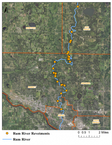
Rum River catchments analyzed in the report (R-1 through R-20).
Mississippi River catchments analyzed in the report (MW-1 through MW-9 and ME-1 through ME-12)

RUM REPORT

A 12,300-acre study area spanning the Cities of Anoka, Andover, and Ramsey was reviewed and narrowed to 20 catchments with a combined area of 1,477-acres to fit within the scope and available budget of the analysis (see map above). Each selected catchment has a defined outfall to the river. In summary, 61 projects were identified throughout the 20 catchments. Project types included bioretention (47, 80% of total) and hydrodynamic devices (12, 20% of total). The prevalence of existing stormwater ponds throughout most of the study area limited the opportunities for large, regional practices.

The prevalence of existing stormwater ponds throughout most of the study area limited the opportunities for large, regional practices. The analyses were funded with BWSR Watershed-based Implementation Funds. Learn more details about these SRA's by reading the full blog article or contact Mitch Haustein, Shoreline and Stormwater Specialist, at This email address is being protected from spambots. You need JavaScript enabled to view it..

  286 Hits

Cedar Tree Revetment's Lasting Impact on the Rum River

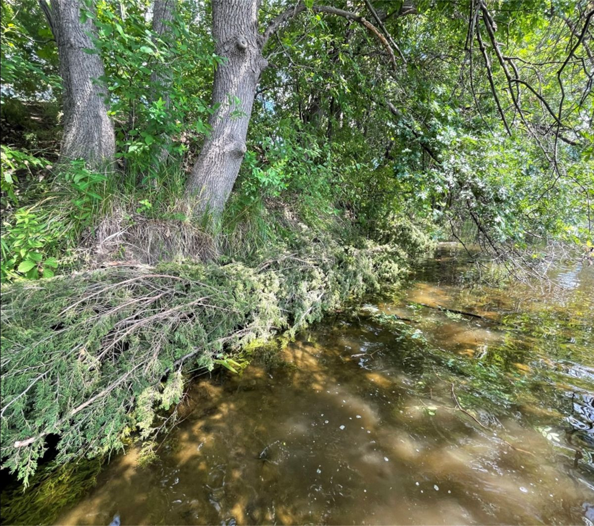
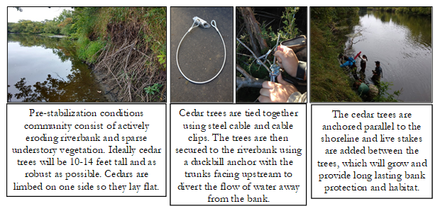
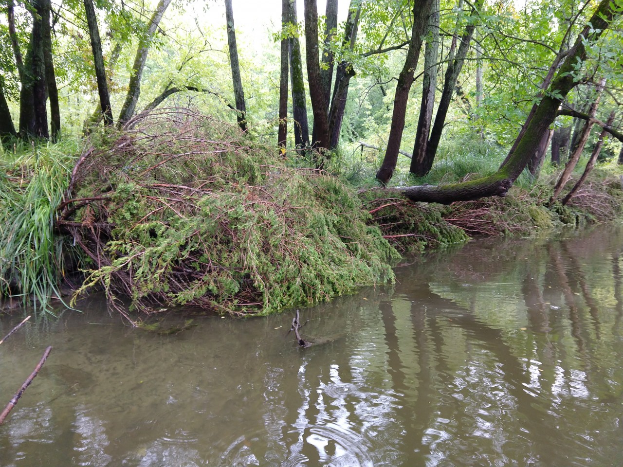
Cedar tree revetments are a low cost, environmentally friendly option to address eroding streambanks. Cedar revetments use Eastern red cedar trees to serve as natural armor, providing protection along eroding riverbanks. Revetments will slow or stop erosion during the project's lifespan and reduce the likelihood of a much larger and more expensive corrective project in the future. Riverbank erosion contributes sediment and other pollutants into waterways, reduces riparian habitat, and results in property loss. Stabilizing your eroding riverbank will provide water quality benefits as well as protect your property. 

Photo: ACD staff with Conservation Corps crew members anchoring a cedar tree into the riverbank. A post pounder is used to drive the tree anchor 3+ feet into the riverbed. 
Photo: Trees are limbed on one side so the trunk is seated into the riverbank. The trees are anchored at the toe-of-bank with the tops of the trees facing downstream. 
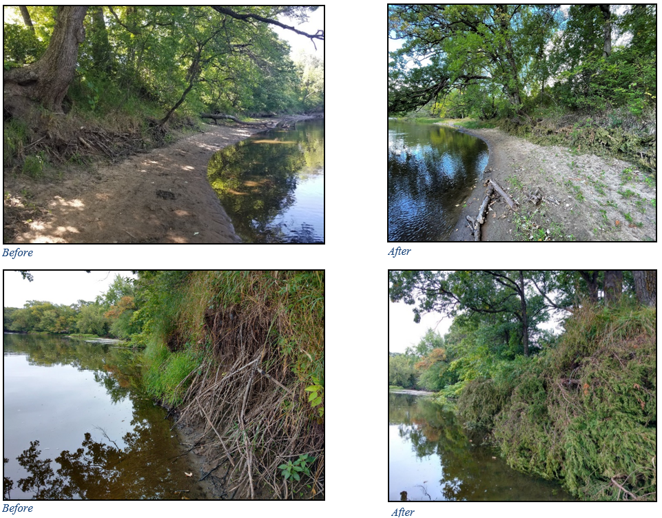
Photo: Before conditions of a riverbank at Rum River Woods park with moderate erosion. If left alone the riverbank will continue to erode and likely get worse overtime.  
Photo: After conditions of the Rum River Woods riverbank showing an installed cedar revetment. The revetment provides erosion protection by shingling the trees together, creating a continuous wall.

For more information contact Kris Larson, Water Resource Specialist, at This email address is being protected from spambots. You need JavaScript enabled to view it.

  367 Hits

Rum Riverbank Stabilization in Oak Grove

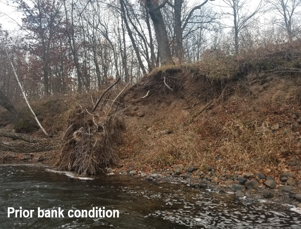
Plans, permits, and bids have come together to stabilize one of the highest priority eroding riverbanks along the Rum River in Anoka County. The project spans multiple properties and will stabilize some of the tallest and most severely eroding riverbanks on the Rum River in Anoka County.

A portion of this stretch was ranked in the top two of over eighty identified eroding banks during a 2017 erosion inventory. Through the stabilization of this stretch of bank, annual pollutant loading to the Rum River is estimated to be reduced by 473-tons of sediment, and 402-lbs of total phosphorus. Construction is planned to begin around September 1st, 2024, and should wrap up prior to winter. Photo: Surveying the tall eroding bank. 

Photo: Landscape shot around eroding bank looking downstream.

Funding sources include grant dollars from the Clean Water Fund and Outdoor Heritage Fund (both from the Clean Water, Land, and Legacy Amendment) as well as match dollars from the landowners, Anoka County, and the Upper Rum River WMO. For more information contact Jared Wagner, Water Resource Specialist, at This email address is being protected from spambots. You need JavaScript enabled to view it.. 

  522 Hits

Funding Available for Cedar Tree Revetments!

What is a Cedar Tree Revetment?
Cedar tree revetments use Eastern red cedar trees to serve as soft, natural armor, providing protection along eroding riverbanks. This protection decreases erosion and allows silt and sand to be deposited overtime. The deposited material forms a bed in which the seeds of riverbank plants such as sedges can grow. By the time the trees have decayed, the bank should be stabilized by the root systems of new plant growth and accumulated sediment. Revetments are ideal for riverbanks experiencing mild to moderate erosion. For riverbanks more than 5 ft. tall or areas with high water velocity, a revetment practice may be inadequate to properly address the issue.

Why Install a Cedar Tree Revetment?

Cedar tree revetments are a low cost, environmentally friendly option to address eroding streambanks. Revetments will slow or stop erosion during the project's lifespan and reduce the likelihood of a much larger and more expensive corrective project in the future. Riverbank erosion contributes sediment and other pollutants into waterways, reduces riparian habitat, and results in property loss. Stabilizing your eroding riverbank will provide water quality benefits to the Rum River as well as protect your property. 

This program is being funded through a Conservation Partners Legacy grant and there is currently funding available to eligible properties. If you live along the Rum River in Anoka County and are interested in learning more about installing a cedar revetment on your property, contact Kris Larson, Water Resource Specialist, at This email address is being protected from spambots. You need JavaScript enabled to view it.. 

  997 Hits

Anoka Riverfront Easement Rum Riverbank Stabilization

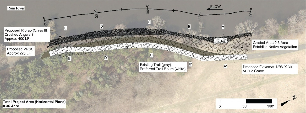
Erosion along 400-feet of Rum riverbank at a City of Anoka riverfront easement is causing sediment loading and tree loss, and has washed out a highly used walking trail. The design features three primary protection measures detailed below. 

1. The toe of the bank, mostly below the water line, will be armored with a rock. The rock will be installed up to the two-year flood elevation (50% of years it will be completely covered). This lowers the top of the rock by two feet compared to the standard approach. This allows habitat friendly approaches above.

2. Above the rock, the bank will be seeded with a native plants, and staked with willow and dogwood. Native vegetation provides habitat benefit and root structure to anchor the soil in place. We may grade the bank back to a flatter, more stable slope. Alternatively, we may use a series of wrapped soil lifts called a "vegetated reinforced soil system" to maintain a steeper slope that is still stable and vegetated. The final decision will be based on bids received.

3. There is a heavily used informal access point at the upstream end of this site. This area gets beat down by heavy foot traffic. We will use one roll of articulated concrete block to offer stable footing and reduce the erosion caused by that foot traffic.

For more information contact Jared Wagner, Water Resource Specialist, at This email address is being protected from spambots. You need JavaScript enabled to view it.. 

  990 Hits

Land Protection

ACD has collaborated with BWSR's RIM program to establish conservation easements to permanently protect, restore, and manage natural resources on private lands. Land protection has many benefits including protecting water quality, habitat, creating conservation corridors, and supporting climate resiliency.  

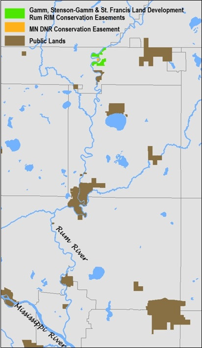
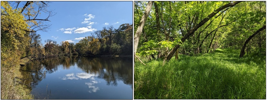
In 2023, two new conservation easements were established along the Rum River. They are adjacent to a conservation easement that was established in 2022 through the Rum RIM program and across the river from a DNR Conservation Easement. These conservation easements create a block of protected land totalling 183.5 acres along 10,960 feet of shoreline. The Gamm, Stenson-Gamm, St. Francis Land Development, and MN DNR Conservation Easement create an additional habitat core with functioning ecosystems and enhance habitat in the Rum River corridor. 

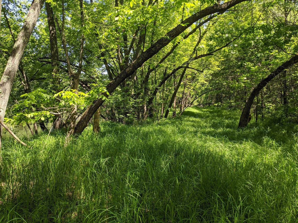
Left to Right: Stenson-Gamm and MN DNR Conservation Easement shorelines. Gamm floodplain forest.v

For more information contact Carrie Taylor, Restoration Ecologist, at This email address is being protected from spambots. You need JavaScript enabled to view it.

  872 Hits

Working in the Rum River to Improve Habitat

A hallmark of ACD's natural resource work has included the stabilization of eroding riverbanks and the enhancement of native vegetation in adjacent riparian and floodplain areas. These activities improve water quality in the river and habitat quality along it. Included in the goals of our Phase 2 grant for Rum River habitat enhancement through the Outdoor Heritage Fund of the Clean Water Land and Legacy Amendment is the improvement of in-stream habitat in the Rum River channel. This is a new endeavor for ACD that presents an exciting opportunity to expand our work and our partnerships within the Rum River Corridor.

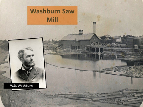
Though we are over a century removed from the widening and scouring of the Rum River by the millions of logs cut during the Minnesota timber boom, the effects of that industry still remain. Rivers used as log arteries were made wider and more consistent to ensure the smooth sailing of logs downstream. In more modern times, towns piped rain water directly to the river from impervious areas via stormwater conveyance systems. These rapid spikes in water input during storms exacerbate bank erosion, down-cutting, and sedimentation in the river at rates far beyond what was natural. 

The Washburn Saw Mill on the Rum River – late 1800s Source: Anoka County Historical Society
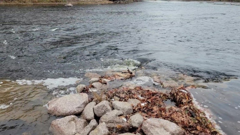
Plunging flow off the end of a bendway weir in the Rum River creating areas of rapid and slow flow, variable water levels, a scour pool, and quiet water depositional areas. This creates variability in flows and habitats.

Due to this historical usage of the Rum River as a conveyance tool for wood and stormwater, habitat for fish, invertebrates, mussels, and other aquatic life remains lacking and out of balance. In the coming years we will be partnering with Anoka County Parks, DNR Fisheries, The Nature Conservancy and others to identify and enhance missing or deficient in-stream habitat. Secondarily, we will look for enhancement opportunities for game fish habitat near publicly accessible shorelines to improve access to quality shore fishing. For more information contact Jared Wagner, Water Resource Specialist, at This email address is being protected from spambots. You need JavaScript enabled to view it.. 

  1297 Hits

Students Involved in Stream Biological Monitoring

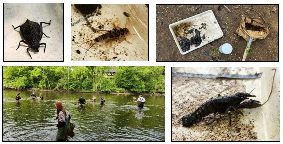
Each season, local high school students venture to a nearby river or stream, grab a dip net and pair of waders, and search for invertebrates (a mix of aquatic insects, crustaceans, bugs, snails, worms, and other critters lacking a backbone) living amongst the submerged rocks and vegetation. They bring their catch back to their partners on shore, who use guides to identify the invertebrates or preserve them for identification at a later date in the lab. In 2023, ACD staff led 560 high school students across 20 classes and 5 schools in these "biomonitoring" efforts. Besides being a great way to get some fresh air, students learned valuable lessons in aquatic ecology. 

Individual aquatic invertebrates have different sensitivities to environmental disturbances such as contamination and habitat loss. Some, such as stonefly and mayfly nymphs, often have a strong negative reaction to disturbance, while others, such as leeches, midges, and aquatic worms, are usually more tolerant and able to persist through a variety of conditions. Understanding these tolerance thresholds across species is an efficient way to broadly assess the health of a waterbody. For example, a high quantity and/ or diversity of species including those considered "intolerant" (sensitive) is a likely indicator of healthy habitat and water quality, whereas the presence of only more "tolerant" species hints at poorer water quality and habitat. Biomonitoring data is often paired with other information, such as water quality or stream morphology data, to identify where aquatic impairments are present and management efforts should be pursued.

After the students have finished collecting and processing samples, ACD staff re-identifies them and summarizes the data in the annual Water Almanac. Through this, big-picture trends in invertebrate communities (and stream health, by extension) can be explored across time. For more information contact Breanna Keith, Water Resource Technician, at This email address is being protected from spambots. You need JavaScript enabled to view it.. 

  731 Hits

More than a River - It's a Trail

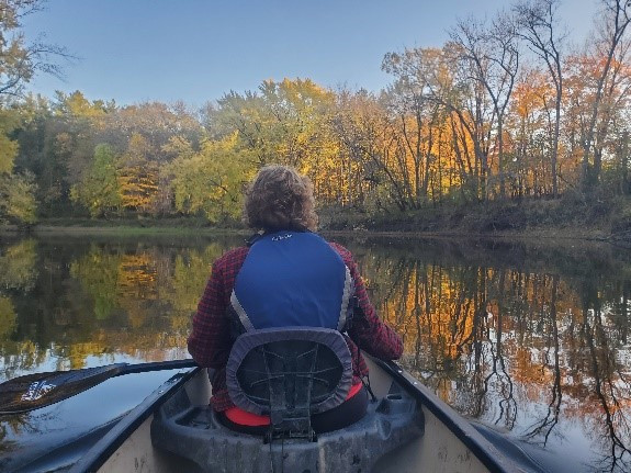
Watershed Projects Manager, Jamie Schurbon, Enjoying the Rum River State Water Trail With His Family

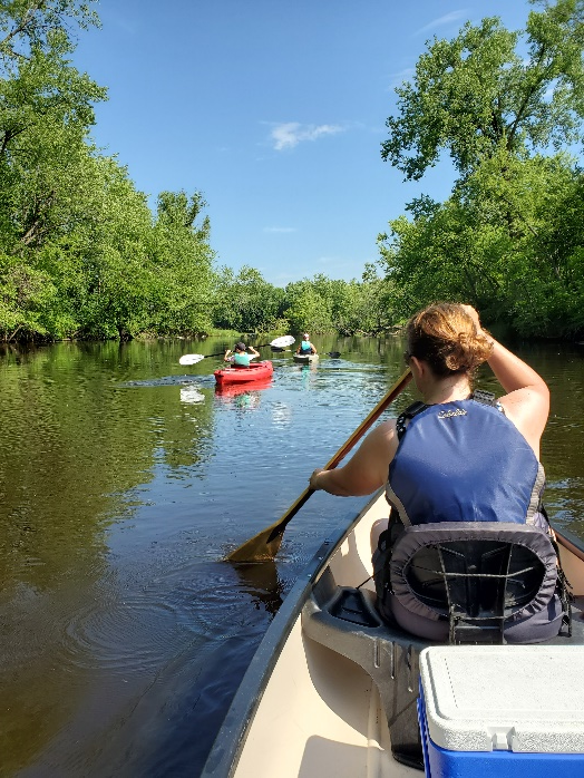
In Anoka County, the Rum and Mississippi Rivers are designated State Water Trails. Like many state trails, information is available about trail access, places to camp, culturally significant areas, and more on the MNDNR's water trails website. ACD is completing a number of projects along both rivers to improve water quality and habitat. We've been especially busy with projects along the Rum River that include wetland restorations, riverbank stabilizations, invasive species management, and habitat protection. Many of these projects are funded in part by the Clean Water, Land and Legacy Amendment.  

  994 Hits

Project Update: Dellwood Park Stabilization

Construction is complete for a Rum Riverbank stabilization at Dellwood River Park in St. Francis. Erosion of the riverbank was resulting in the loss of numerous trees into the river and was threatening a popular local walking trail. The project design features three primary protection measures.

  1. Two severely eroding zones of riverbank were armored with rock riprap, and 14 large tree rootwads were added as in-stream habitat.
  2. Three rock bendway weirs were installed, protruding at 45° into the river. These low-lying features, will push flow and erosive scour back toward the middle of the channel, rather than along the outer bank.
  3. And finally, the less severely eroding areas of riverbank were armored with cedar trees in a bio-engineering technique called "cedar tree revetments".

In total, this project stabilizes 630 feet of riverbank, enhances 0.75 acres of in-stream and riparian habitat, and reduces annual loading into the river by 60 tons of sediment and 51lbs of phosphorus. The project also incorporates multiple features to enhance fishing opportunities and provide additional in-stream habitat. 

Previous Bank Conditions, 2022
Lead Staff, Jared Wagner, Post-Construction, November 2023

For more information contact Jared Wagner, Water Resource Specialist, This email address is being protected from spambots. You need JavaScript enabled to view it. 

  1270 Hits

$1.7M of Habitat Enhancement for the Rum River Corridor

$1.7M of state funds from the Outdoor Heritage Fund of the Clean Water, Land and Legacy Amendment was awarded for habitat enhancement in the Rum River Corridor. A broad-based partnership will bring an additional $215,000 in local matching funds. We will use these funds to enhance wildlife habitat from the headwaters in Lake Mille Lacs to where the Rum River joins the Mississippi River in Anoka. The Rum River Corridor is critical habitat for many rare species, including Blanding's Turtle and two types of mussels, to name a few. We will be doing habitat improvement projects from in the river to beyond the banks.

Links:
Clean Water, Land and Legacy Amendment
Lessard-Sams Outdoor Heritage Council
Outdoor Heritage Fund

For more information visit the links above or contact Jared Wagner at This email address is being protected from spambots. You need JavaScript enabled to view it. or 763.434.2030 x200
  1024 Hits

Rum RIM protects 149 acres and 8,370 feet of shoreline in northern Anoka County

Anoka Conservation District and other SWCDs are working together to prioritize parcels and enroll willing landowners in BWSR's Reinvest in Minnesota (RIM) Reserve in the Rum River Watershed. The RIM Reserve program compensates landowners who are willing to give up development rights on their land in perpetuity to permanently preserve the natural landscape. The Rum River flows from Lake Mille Lacs to the Mississippi River through diverse landscapes and land uses. Protecting priority lands will benefit water quality and Twin Cities' drinking water supply, as well as improving wildlife habitat and connectivity. 

ACD is grateful to the families in northern Anoka County who just recently enrolled their land in BWSR's RIM program. Those families cherish the natural state of their land and the Rum River. Thanks to them, 149 more acres of land will be protected.

  1090 Hits

Rum Riverbank Washout Stabilized Near Rum River Central Boat Ramp

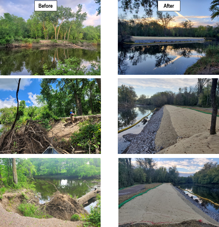
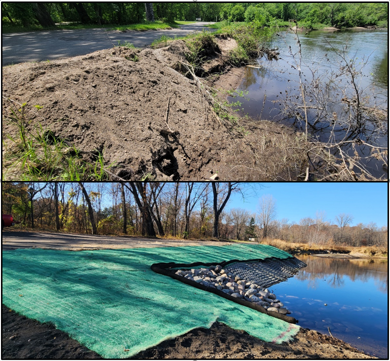
In May of 2022, the Rum River reached its highest peak flow since 2001 following torrential rain events in Isanti and Mille Lacs Counties. The roadway to the boat ramp in Rum River Central Regional Park in Anoka County was inundated under feet of water. When the floodwaters receded, 90 linear feet of bank had completely washed out, threatening the roadway and boat ramp, and leaving and exposed eroding bank dumping sediment into the river. This section of washed out riverbank was stabilized using a Flexamat PLUS articulated concrete mat at the toe, and a regraded and native-seeded slope above. A rock barb installed at the downstream end will provide in-channel habitat for fish and invertebrates while also kicking flow out away from the boat ramp.

The Flexamat articulated concrete was chosen for this project because an immediately adjacent project installed in 2015 is still holding very successfully, even after the flooding. An advantage of Flexamat vs. rock is that the Flexamat has void spaces that allow vegetation to grow between the blocks, masking the concrete during low water conditions, and providing additional habitat benefit. Traditional riprap does not allow this vegetation growth, and can look like a rock wall during low water.

In the spring, we will add bare root seedlings of shoreland tree and shrub species to the project site. The native grasses and sedges seeded into the bank will begin to grow, and the whole bank will establish deep-rooted native vegetation which will keep the soil anchored for years to come. A video short of this project can be found on ACD's YouTube page: https://www.youtube.com/shorts/eUHBV5TSNi8. To see other streambank stabilization projects installed throughout Anoka County, please see the virtual project tour on ACD's website. 

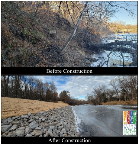
Before (top) and after (bottom) of 90-feet of streambank stabilized at Rum River Central Regional Park.
  1180 Hits

Stabilizing Riverbanks in Anoka

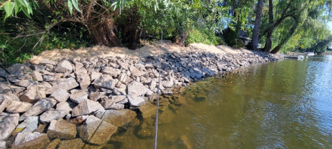
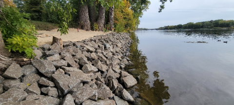
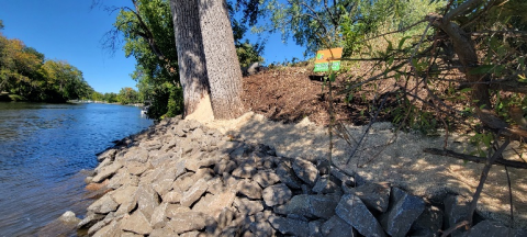
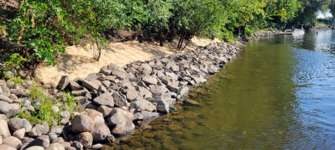
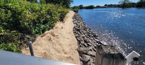
Construction is complete on six streambank toe stabilization projects on the Rum and Mississippi Rivers in Anoka. These sites have had significant and accelerating erosion in recent years due to sustained high water and recreational watercraft. Most of the sites lie between two popular boat launches on the rivers.

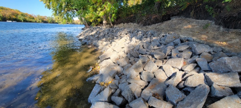
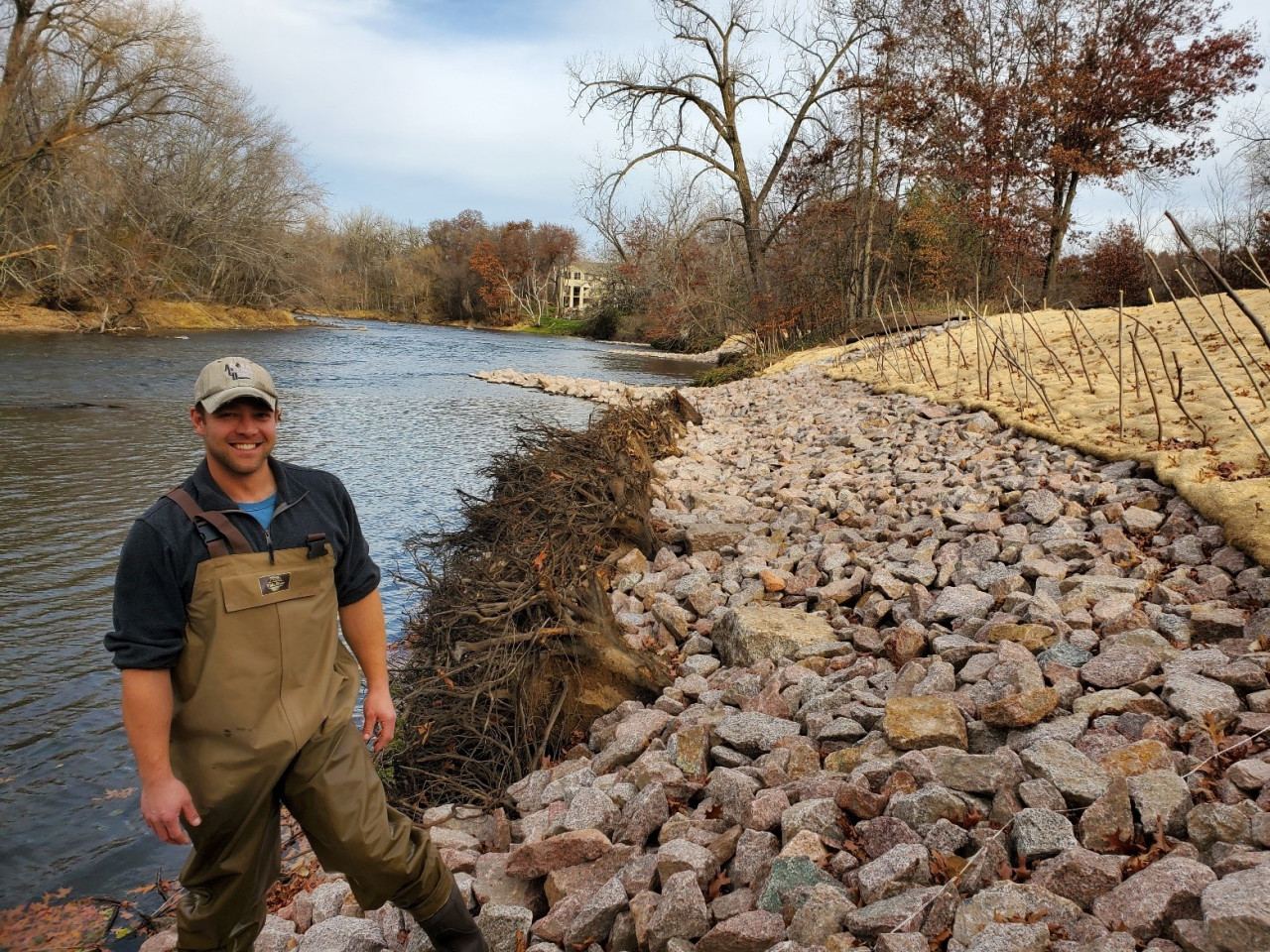
Cumulatively, over 720 linear feet of eroding riverbank was stabilized. The primary stabilization technique is rock riprap installed on the lower portion of the slope, with a seeded and blanketed vegetative zone above the rock. The primary immediate goal of these projects was to halt the backwards march of the riverbanks by stabilizing the lower portion (or toe). An additional vegetation component is planned for these sites in the following year(s) to help stabilize the upper slope, which is only subject to wave action during the highest water periods. This vegetative zone will be comprised of native woody species, as well as grasses, sedges, and forbs, to enhance the habitat and aesthetic value of the shorelines, while also providing deep root structure to anchor the soil in place above the rock. 

The projects were done via barge from the water, a first for ACD-managed projects. Many of these sites had been on our inventories, but were not cost-effectively constructible from land. With a contractor that can install projects from the water, concerns about equipment access between buildings and site restoration on individual properties are non-factors. Beyond stabilizing these six eroding shorelines, we are hopeful that this new construction technique opens up more potential streambank stabilization projects that would have otherwise not been possible or cost-effective from land. To see these and other streambank stabilization projects installed throughout Anoka County, please see the virtual project tour on ACD's website. 

  1347 Hits

Stabilizing Riverbanks in Anoka

Construction is beginning on six streambank stabilization projects on the Rum and Mississippi Rivers in Anoka. These sites have had significant and accelerating erosion in recent years due to sustained high water and recreational watercraft. Most of the sites lie between two popular boat launches on the rivers.

Cumulatively, over 720 linear feet of eroding riverbank will be stabilized. The primary stabilization technique will be rock riprap on the lower portion of the slope, with a seeded and blanketed vegetative zone above the rock. This vegetative zone will be comprised of native species of grasses, sedges, and forbs to enhance the habitat and aesthetic value of the shorelines, while also providing deep root structure to anchor the soil in place above the rock. 

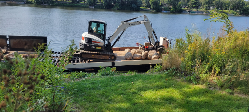
Mini excavator applying rock to a shoreline on the Mississippi River via barge

The projects will be done via barge from the water, a first for ACD-managed projects. Many of these sites had been on our inventories, but were not cost-effectively constructible in a typical fashion from land. With a contractor that can install the project from the water, concerns about equipment access between buildings and site restoration on individual properties are non-factors. Beyond stabilizing these six eroding shorelines, we are hopeful that this new construction technique opens up more potential streambank stabilization projects that would have otherwise not been possible from land.

Project updates will be provided as construction progresses. To see these and other streambank stabilizations projects already installed throughout Anoka County, please see the virtual project tour on ACD's website. 

  1535 Hits

Construction Underway for Anoka Rain Gardens

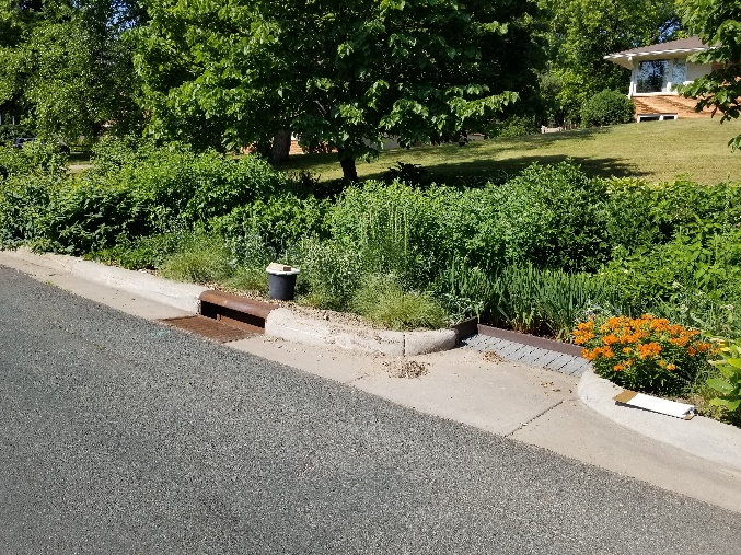
A thriving rain garden installed in Columbia Heights in 2018. With proper maintenance, native species planted in rain garden will fill the entire space within ~3 years.


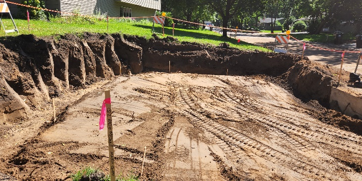
Four rain gardens are being installed in a northern Anoka neighborhood as part of the City's 2022 Street Surface Improvement Project. Collectively, these gardens will capture nearly 10 acres' worth of stormwater runoff (over 700,000 gallons annually) which would otherwise drain untreated to the Rum River. Through this, sediment loading to the river will be reduced by 969 pounds/year, and total phosphorus loading will be reduced by 3 pounds/year.

Each garden will provide additional ecological benefits through the planting of a diverse range of native species, creating several hundred square feet of rich pollinator habitat within the Rum River corridor. 

The largest of the four Anoka rain gardens – a double inlet project which will treat stormwater from two adjacent roadways.

Funding for project design was provided by the Metropolitan Conservation Districts Engineering and Technical Assistance Program, and funding for construction is provided by the City of Anoka and State Watershed-based Implementation Funding. 

  1265 Hits

The Oxbows of the Rum River

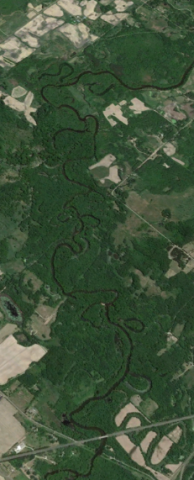
The Rum River in Isanti County


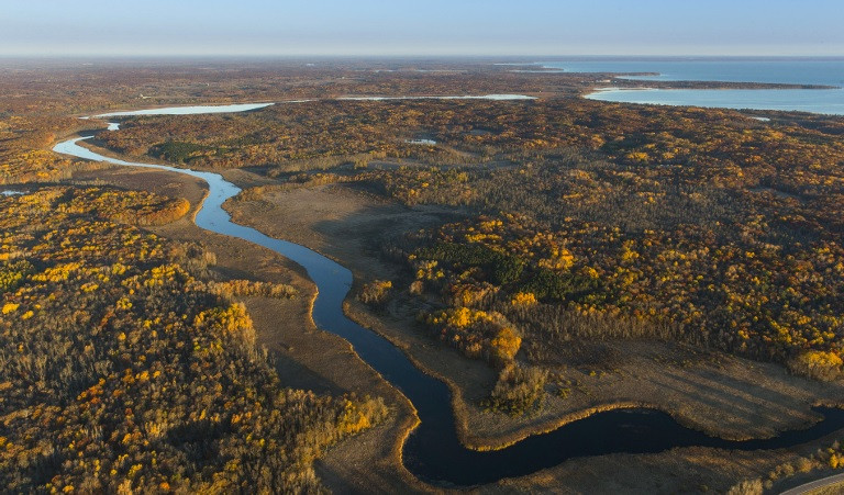
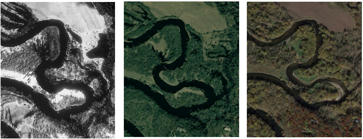
When allowed to wander freely, rivers flowing throughout a gently sloped landscape form a snakelike meandering path. This occurs as the fastest moving waters erode banks along the outer bends, and slower moving waters deposit sediment along the inner bends. Over many years, these processes cause the meanders to curve more intensely, causing the river to eventually loop back onto itself and cut a straight path through the narrow slice of land that remains. Now disconnected from the river, the C-shaped meander scar is called an oxbow.

To watch these processes in action, check out this video: Why Do Rivers Curve?

A quick glance at aerial imagery reveals numerous oxbow wetlands alongside the Rum River. They are rich in plant and animal life, serving as a "nursery" for fish, invertebrates, and amphibians in their early life stages while providing habitat for countless migratory bird species. These oxbows also improve water quality and reduce flooding by capturing water and the contaminants it carries following large storm events.

To learn more about the importance of oxbow wetlands and their utility in water resource management, read the Nature Conservancy's article on the topic here: What is an Oxbow? 

Aerial photos of a Rum River meander in Ramsey captured in 1991, 2003, and 2021 (left-right). Notice the increasingly thin sliver of land at the base of the curve, which eventually transitions to a river cut-through.
  1427 Hits

Rain Gardens Benefitting the Rum River

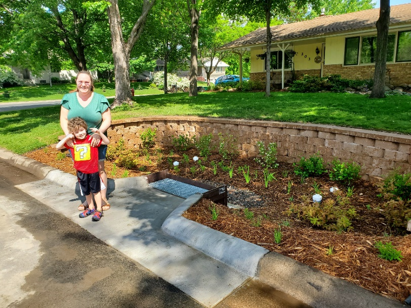
Six new rain gardens will be installed this summer in Anoka and Ramsey to benefit the Rum River. The first of them, on Washington Street, was completed the first week of June. Each curb-cut rain garden captures water from the neighborhood streets, driveways, roofs and other surfaces. Prior to these projects, the stormwater is discharged directly to the Rum River without treatment. Rain gardens are ideal in built-out neighborhoods where space is not available for stormwater ponds or other larger practices.

Funding for two rain gardens is a state Clean Water Fund grant and the Lower Rum River Watershed Management Organization. Funding for the other four is the City of Anoka as part of their 2022 street renewal project. 

Bowler family members Amanda and Connor at the newly constructed rain garden in their front yard (not pictured: Daniel Bowler). The Bowlers will own and maintain the rain garden which treats stormwater from 2.2 acres of their neighborhood.
  1552 Hits

Rum Riverbank Stabilization Grants Available

A recent shoreline stabilization project on the Rum River

Grant funds are available to landowners for addressing shoreline erosion on the Rum River. If your shoreline is falling into the river, migrating back over time, or the bottom has washed out leaving an overhang, these funds can pay for a substantial portion of design and construction of a solution. Funding is available to address erosion issues of all sizes, with landowners typically paying 15-25% of the project cost. Shoreline restoration does more than just protect your property. It also protects the water resource you live on and enhances river habitat!

Those interested can schedule a site visit with Anoka Conservation District (ACD) staff to discuss options and see if your shoreline might fit into one of our various grant programs for financial assistance. Because the design and construction bidding can take months, starting in the spring is recommended. Contact Jared Wagner at ACD at 763-434-2030 x200 or This email address is being protected from spambots. You need JavaScript enabled to view it..

Rum Riverbank stabilization projects are a partnership of ACD, Anoka County Parks, and the Upper and Lower Rum River Watershed Management Organizations (URRWMO, LRRWMO) with funding from the Clean Water Land and Legacy Amendment.

  1303 Hits

Rum River Watershed Partners Decide on Projects to Fund

The Rum River is a focus for new grant funds aimed at protecting water quality and improving habitat.

Local entities with a role in managing the Rum River watershed in Anoka County recently decided on a new slate of grant-funded projects. The group was charged with allocating $371,157 in state Watershed Based Implementation Funding grants. The dollars can be used for water quality projects in approved local plans. From an initial menu of 19 projects the group selected five:

  • $176,000 Projects identified in subwatershed studies. This includes urban stormwater and agricultural practices that have been identified, ranked by cost effectiveness, and which drain to one of these priority waterbodies: Rum River, Mississippi River, or Ford Brook.
  • $30,000 Trott Brook riparian corridor restoration study. This stream is impaired for low oxygen and poor aquatic life. The study is aimed at finding out why, and what might be done to address it. Trott Brook is primarily in the City of Ramsey.
  • $65,000  Septic system fix ups for low income homeowners. This will supplement an existing $25-40K per year that the state provides to the Anoka Conservation District. Demand exceeds funding. Properties near priority waterbodies are the focus.
  • $65,175 Critical shoreland area planting. Plantings will improve habitat, prevent erosion, and filter runoff near waterbodies.
  • $35,000 Wetland restorations.

The group selected the Anoka Conservation District to manage the projects. Required 10% grant matching dollars will come from landowners where projects are completed, and the Upper and Lower Rum River Watershed Management Organizations. Work will begin in late 2022.

The group that worked collaboratively to select these projects included the Upper and Lower Rum River Watershed Management Organizations, Anoka Conservation District, Anoka County, and a city representative from Andover.

  1340 Hits

Simple Erosion Control Techniques Brings Success on the Rum River

Cedar tree revetments are a cost-effective bioengineering practice that can be used to stabilize actively eroding riverbanks. Excessive erosion along riverbanks threatens property, contributes sediment and nutrients to the water, and eliminates wildlife habitat. Installation of cedar revetments and live stakes, slows or stops the erosion and reduces the likelihood of a much larger and more expensive project in the future.

Eastern red cedars, though native to Minnesota, can be a nuisance species with a habit of taking over and dominating open grassy spaces. These cedar trees can be obtained at little to no cost through land clearing efforts and repurposed to protect streambanks and provide habitat benefit. Efforts made by ACD throughout the last 10-years have resulted in large-scale pollution reduction and extensive land protection along the Scenic Rum River. 

Since 2015, ACD has partnered with landowners, cities, parks departments, schools, and other community groups to install approximately 8,666 linear feet of cedar revetment. At the end of the 10-year project life, the current revetments in Anoka County will prevent in excess of 2,370 tons of sediment and 2,180 lbs of phosphorus from entering the Rum River, based on loading estimates.

Funding for these project was made possible through the Conservation Partners Legacy, Conservation Corps of Minnesota & Iowa crew labor grants funded from the Clean Water, Land, and Legacy Amendment, and contributions from landowners. ACD provided all project administration, design and installation oversight.

  1501 Hits

Rum Watershed Comp Plan Nearly Done!

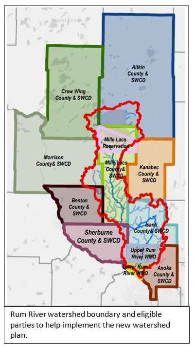
Counties, soil & water conservation districts, watershed organizations and the Mille Lacs Band of Ojibwe have created a Rum River Comprehensive Watershed Management Plan (CWMP). The plan contains mutual priorities for water quality improvements and other natural resources. State approval of the plan is anticipated for May.

The management plan was created because there are 15+ local water plans managing different parts of the same watershed, making it hard to reach watershed-level goals. The CWMP is a single umbrella plan prioritizing resources across the entire watershed. Activities in the plan include shoreland erosion stabilization, agricultural water quality projects, stormwater treatment, septic system fix ups for low income owners, forestry practices, and more.

Approximately $1M in State Watershed Based Implementation Funds (WBIF) grants are provided every two years to implement the plan. The partnership is forming a joint powers board to direct plan implementation and grant funds use.

The full plan is available at https://www.millelacsswcd.org/rum-river-one-watershed-one-plan/.For more information contact Jamie Schurbon (This email address is being protected from spambots. You need JavaScript enabled to view it. or 763-434-2030 ext. 210). 

  1560 Hits

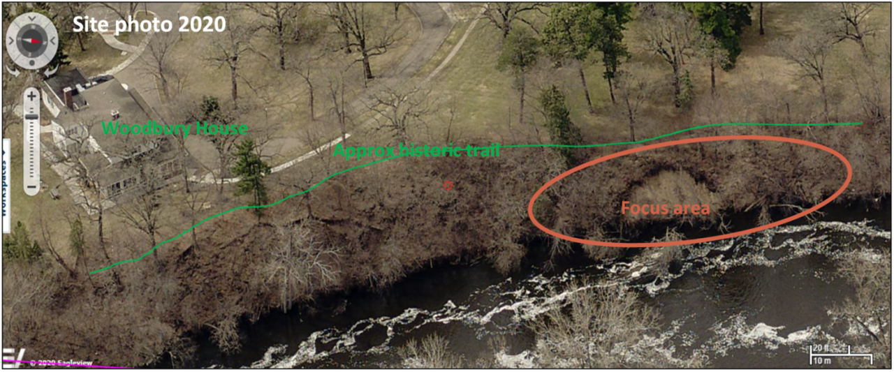
$1,008,820 Grant for Rum Riverbank Stabilization at Woodbury House!

The Anoka Conservation District (ACD) is collaborating with the City of Anoka to stabilize 300+ linear feet of eroding Rum Riverbank adjacent to the historic Woodbury House site. The ACD recently prepared a state Clean Water Fund grant application on behalf of the city, and the city is being awarded a $1,008,820 grant. It promises to be a high profile and highly beneficial project.

This site is important for water quality and cultural reasons. It is on the Rum River and less than 1/2 mile upstream of the confluence with the Mississippi River. Reduction of sediment and nutrients in both these rivers is a regional priority. The site is also immediately upstream of Twin Cities drinking water intakes, so there are drinking water benefits. The Woodbury House itself is on the National Register of Historic Places. The house was built in 1857 and is currently occupied by the Mad Hatter Restaurant and Tea House. Work will take place on city-owned lands.

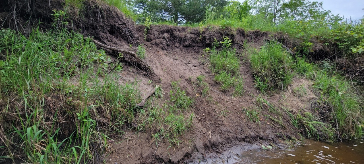
Currently, the riverbank has major failures extending up the 30+ foot tall bluff that are increasing in extent. Erosion affects river water quality, fish habitat, and threatens structures at the top of the bluff. 

The Clean Water Fund is from the Clean Water, Land and Legacy Amendment passed by voters in 2008.  

  1633 Hits

Rum Riverbank Stabilization in Oak Grove

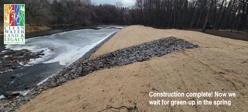
A project stabilizing 400 linear feet of severely eroding Rum Riverbank is complete in Oak Grove! Construction was completed in November which included;

  • Installation of 850 tons of rock riprap
  • Grading the bank to a more stable slope
  • Blanketing and seeding with a native seed mix
  • Planting native willows and dogwood trees
  • Blanketing the soil with straw to protect it until the vegetation grows

The project was funded by an Outdoor Heritage Fund grant through the Lessard Sams Outdoor Heritage Council, as well as match dollars from the landowner and Anoka County. The Outdoor Heritage Fund is one of 4 funds created by the Clean Water, Land and Legacy Amendment. This project will prevent approximately 140 tons of sediment per year from washing into the river, and will enhance wildlife habitat along 400 feet of riverbank that had been a non-traversable eroding face prior.

Stay tuned for more photo updates as the project greens up this coming spring! 

  1319 Hits

Clean Water Funds for Eroding Rum Riverbanks

The Board of Water and Soil Resources (BWSR) is recommending $440,000 in funding to ACD from the Clean Water Fund[1] competitive grant fund for stabilizing eroding Rum Riverbanks. This funding will be used in conjunction with funds already received from the Lessard-Sams Outdoor Heritage Council[2] ($816,000 to ACD) and the DNR Conservation Partners Legacy[3] grant ($185,000 to Anoka County Parks) for Rum Riverbank stabilization and habitat enhancement projects. These three funding sources will cover projects of all sizes, from small banks only needing cedar tree revetments to large failing banks requiring sophisticated engineering and reconstruction. The funds from the Clean Water Fund grant will be prioritized for the latter.

With additional matching funds from Anoka County, the Upper and Lower Rum River WMOs, ACD and landowners, over $1.5M-worth of streambank projects will be installed over the next three years to help the Rum River. The Rum River is a highly prized resource in Anoka County, but it is on the brink of impairment for phosphorus concentrations, and it has extensive bank erosion. The sediment washing into the river from these eroding banks dirties the water, increases nutrients, and smothers habitat for aquatic wildlife. ACD performed a streambank erosion analysis[4] from 2017 to 2019 that led to this concerted effort by ACD and Anoka County to secure state grant funding and local matching funds to make a big push to help the River. 

  1762 Hits

History and Management of the Rum River

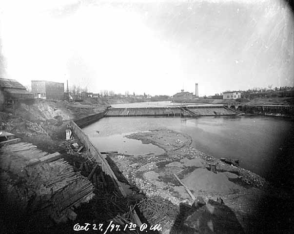
Anoka Dam, October 1897

The Rum River is one of the largest rivers in Anoka County, second only to the mighty Mississippi. It starts at the outlet of Mille Lacs Lake and winds through the landscapes of Mille Lacs, Isanti, and Anoka Counties until it discharges to the Mississippi River in the City of Anoka—but many don't know about the progress this river has made to become one of Minnesota's most outstanding waterways.

To really appreciate the Rum River today, it's good to understand a bit of its history. For many decades, the Rum River served as a large scale aquatic conveyor for lumber. Large white pine, elm, oak, cherry, and maple all floated down the river from central Minnesota forests to build the homes and business of the growing Twin Cities Metro Area. It also conveyed our sewage, agricultural waste, sediment laden runoff, and industrial by-products downstream to the Mississippi River, and eventually the Gulf of Mexico.

A former Anoka County commissioner who grew up in the area once said that when he was a kid, no one would dare to even fish in the Rum River, much less swim in it. I'm happy to say, over the last 80 years, the fate of the Rum River has been wholly reversed. Today the Rum River is:
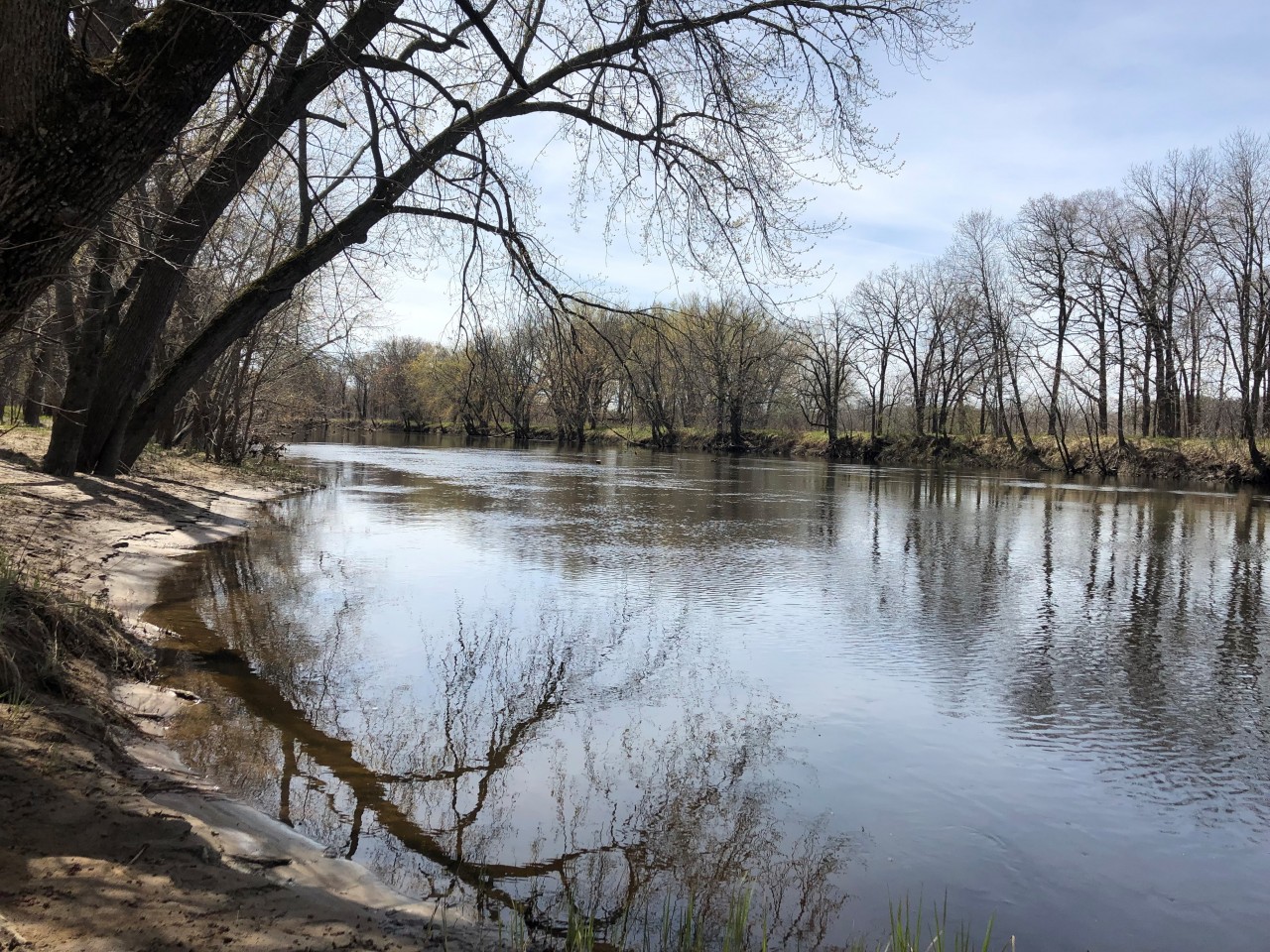
Martin's Landing on the Rum River
  • One of 6 Wild and Scenic Rivers and 35 State Water Trails in Minnesota
  • Designated as an Outstanding Resource Value Water
  • An excellent fishery and waterfowl corridor with abundant smallmouth bass and wood duck
  • Key reach for Species in Greatest Conservation Need

This isn't to say that our Rum River is in the clear. In the last 30 years, the population in the area draining to the Rum River has increased by 47%. With that many people came more roads, parking lots, and roof tops that added 74% more stormwater runoff. The increased water volume and speed that came with this extra stormwater caused the river to slice deeper into the landscape and rip apart the riverbanks. When riverbanks collapse into the river, the resulting sediment smothers the fish, amphibians, and reptiles that now call the river home. The Rum River is also increasingly threatened by road salt and nutrient pollution coming from this stormwater.

A Cedar Tree Revetment installed to stabilize a bank on the Rum River.

ACD takes a holistic approach to managing these new challenges to the quality of the Rum River. We are heavily involved with monitoring the chemistry and biological quality of the River; we assist the local Watershed Management Organizations with analysis and planning; and we implement projects with willing landowners to improve water quality and habitat in the river. ACD is also involved with guiding land conservation projects near the Rum River needed to protect habitat and water quality, and we are working diligently with other local organizations to ensure future funding for projects protecting the Rum River.

Over the coming months, we will be posting short blogs to highlight individual projects and programs that ACD has directed for the benefit of the Rum River. Check in soon at www.anokaswcd.org/blog to learn more!

  7651 Hits